Picture 1 of 10


Gallery
Picture 1 of 10


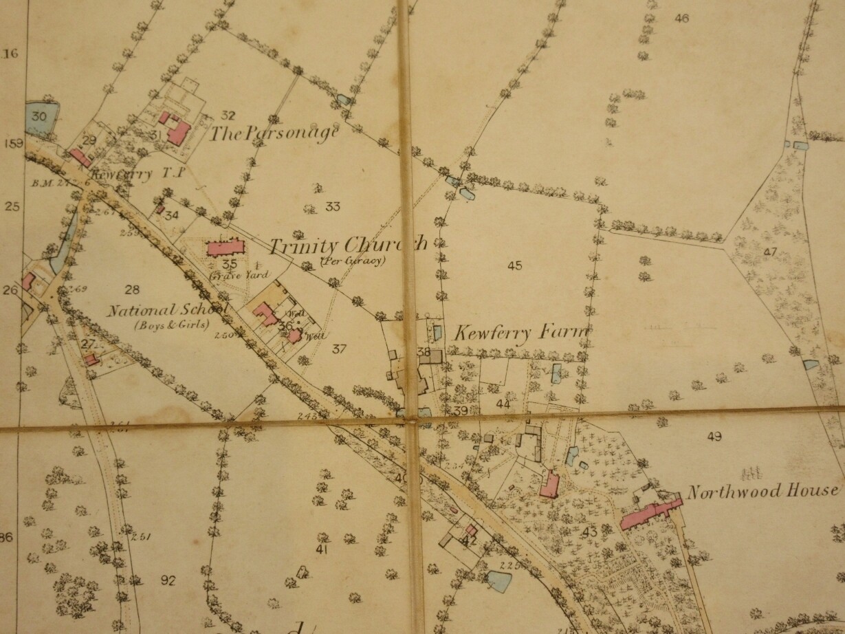


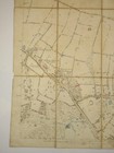
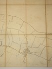
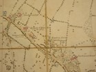
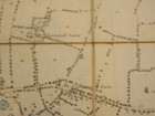
Ordnance Survey Map of Middlesex V.13 1:2500 Northwood/Hill
GBP 56.00
ApproximatelyPHP 4,225.40
Condition:
“Overall condition is Very Good. See description for full details and photos.”
Oops! Looks like we're having trouble connecting to our server.
Refresh your browser window to try again.
Shipping:
GBP 15.00 (approx PHP 1,131.80) International Tracked Postage.
Located in: Tarrington, Herefordshire, United Kingdom
Delivery:
Estimated between Fri, 6 Jun and Wed, 18 Jun to 94104
Returns:
30 days return. Buyer pays for return shipping. If you use an eBay shipping label, it will be deducted from your refund amount.
Coverage:
Read item description or contact seller for details. See all detailsSee all details on coverage
(Not eligible for eBay purchase protection programmes)
Seller assumes all responsibility for this listing.
eBay item number:375217923003
Item specifics
- Seller Notes
- “Overall condition is Very Good. See description for full details and photos.”
- Publisher
- The Ordnance Survey
- Signed
- No
- Binding
- Paperback
- Subject
- Exploration & Travel
- Year Printed
- 1879
- Special Attributes
- 1st Edition
- Origin
- English
- Country/Region of Manufacture
- United Kingdom
- Original/Facsimile
- Original
- Original/Reproduction
- Original
- Format
- Paperback
- Date of Publication
- 1850-1899
- Printing Year
- 1850-1899
- Modified Item
- No
- Personalised
- No
- Fiction Subject
- Non-Fiction
- Non-Fiction Subject
- Geography
- Place of Publication
- London
- Weight
- 500g
- Language
- English
- Inventory Number
- 1218E201
Item description from the seller

Seller feedback (8,681)
- Évaluations automatiques eBay- Feedback left by buyer.Past monthCommande terminée - avec suivi et dans les délais
- Évaluations automatiques eBay- Feedback left by buyer.Past monthCommande terminée - avec suivi et dans les délais
- Évaluations automatiques eBay- Feedback left by buyer.Past monthCommande terminée - avec suivi et dans les délais