
Picture 1 of 4
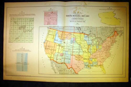


1911 Grays Principal Meridians and Baselines United States Map 18¾" x 28½"
Condition:
“This map is in very good condition.”
Postage:
Located in: Corunna, Michigan, United States
Delivery:
Estimated between Thu, 30 May and Sat, 1 Jun to 43230
Returns:
Coverage:
Read item description or contact seller for details. See all detailsSee all details on coverage
(Not eligible for eBay purchase protection programmes)
Seller assumes all responsibility for this listing.
eBay item number:363895147496
Item specifics
- Seller Notes
- “This map is in very good condition.”
- Cartographer/Publisher
- Frank A. Gray
- Printing Technique
- Engraving
- Original/Reproduction
- Original
- Format
- Atlas Map
- Type
- Plat map
- Year
- 1912
- US State
- Ohio
- Date Range
- 1910-1919
- Country/Region
- Preble County Ohio
Item description from the seller
Seller assumes all responsibility for this listing.
eBay item number:363895147496
Postage and handling
Item location:
Corunna, Michigan, United States
Post to:
Afghanistan, Albania, Algeria, Andorra, Angola, Anguilla, Antigua and Barbuda, Argentina, Armenia, Aruba, Australia, Austria, Azerbaijan Republic, Bahamas, Bahrain, Bangladesh, Belgium, Belize, Benin, Bermuda, Bhutan, Bolivia, Bosnia and Herzegovina, Botswana, Brazil, Brunei Darussalam, Bulgaria, Burkina Faso, Burundi, Cambodia, Cameroon, Canada, Cape Verde Islands, Cayman Islands, Central African Republic, Chad, Chile, China, Colombia, Costa Rica, Cyprus, Czech Republic, Côte d'Ivoire (Ivory Coast), Democratic Republic of the Congo, Denmark, Djibouti, Dominican Republic, Ecuador, Egypt, El Salvador, Equatorial Guinea, Eritrea, Estonia, Ethiopia, Fiji, Finland, France, Gabon Republic, Gambia, Georgia, Germany, Ghana, Gibraltar, Greece, Greenland, Grenada, Guatemala, Guinea, Guinea-Bissau, Guyana, Haiti, Honduras, Hong Kong, Hungary, Iceland, India, Indonesia, Ireland, Israel, Italy, Jamaica, Japan, Jordan, Kazakhstan, Kenya, Kiribati, Kuwait, Kyrgyzstan, Laos, Latvia, Lebanon, Lesotho, Liberia, Liechtenstein, Lithuania, Luxembourg, Macau, Macedonia, Madagascar, Malawi, Malaysia, Maldives, Mali, Malta, Mauritania, Mauritius, Mexico, Moldova, Monaco, Mongolia, Montenegro, Montserrat, Morocco, Mozambique, Namibia, Nauru, Nepal, Netherlands, New Zealand, Nicaragua, Niger, Nigeria, Norway, Oman, Pakistan, Panama, Papua New Guinea, Paraguay, Peru, Philippines, Poland, Portugal, Qatar, Republic of Croatia, Republic of the Congo, Romania, Rwanda, Saint Kitts-Nevis, Saint Lucia, Saint Vincent and the Grenadines, San Marino, Saudi Arabia, Senegal, Serbia, Seychelles, Sierra Leone, Singapore, Slovakia, Slovenia, Solomon Islands, South Africa, South Korea, Spain, Sri Lanka, Suriname, Swaziland, Sweden, Switzerland, Taiwan, Tajikistan, Tanzania, Thailand, Togo, Tonga, Trinidad and Tobago, Tunisia, Turkey, Turkmenistan, Turks and Caicos Islands, Uganda, United Arab Emirates, United Kingdom, United States, Uruguay, Uzbekistan, Vanuatu, Vatican City State, Vietnam, Wallis and Futuna, Western Samoa, Yemen, Zambia, Zimbabwe
Excludes:
Barbados, French Guiana, French Polynesia, Guadeloupe, Libya, Martinique, New Caledonia, Reunion, Russian Federation, Ukraine, Venezuela
| Postage and handling | To | Service | Delivery*See Delivery notes |
|---|---|---|---|
| US $6.35 (approx PHP 369.06) | United States | Standard Postage (USPS First Class®) | Estimated between Thu, 30 May and Sat, 1 Jun to 43230 |
| Handling time |
|---|
| Will usually ship within 1 business day of receiving cleared payment. |
| Taxes |
|---|
| Taxes may be applicable at checkout. Learn moreLearn more about paying tax on eBay purchases. |
Sales Tax for an item #363895147496
Sales Tax for an item #363895147496
Seller collects sales tax for items shipped to the following states:
| State | Sales Tax Rate |
|---|
Return policy
| After receiving the item, contact seller within | Refund will be given as |
|---|---|
| 30 days | Money Back |
The seller is responsible for return postage costs.

Seller feedback (9,647)
9***s (2935)- Feedback left by buyer.
Past month
Verified purchase
Fast shipping and as described! Very pleased!
n***1 (2)- Feedback left by buyer.
Past month
Verified purchase
Price, product, promotion, place of distribution all perfect.
l***e (1724)- Feedback left by buyer.
Past month
Verified purchase
Thank you