Picture 1 of 12


Gallery
Picture 1 of 12


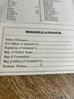
AIR-LINE DISTANCES TABLE & VILLAGE PLANS F.W. BEERS 1874 LITCHFIELD COUNTY ATLAS
US $34.99
ApproximatelyPHP 1,951.08
Condition:
“GOOD”
Oops! Looks like we're having trouble connecting to our server.
Refresh your browser window to try again.
Shipping:
US $9.75 (approx PHP 543.67) USPS First Class®.
Located in: Ocean Isle Beach, North Carolina, United States
Delivery:
Estimated between Thu, 5 Jun and Thu, 12 Jun to 94104
Returns:
No returns accepted.
Coverage:
Read item description or contact seller for details. See all detailsSee all details on coverage
(Not eligible for eBay purchase protection programmes)
Seller assumes all responsibility for this listing.
eBay item number:226308608972
Item specifics
- Seller Notes
- “GOOD”
- Date Range
- 1800-1899
- Type
- County Map
- US State
- Connecticut
- Format
- DISTANCES
- Printing Technique
- Lithography
- Year
- 1874
- SIZE
- APPROX 12 X 15
- Original/Reproduction
- Antique Original
- Cartographer/Publisher
- F.W. BEERS
- City
- LITCHFIELD COUNTY
- Country/Region
- United States of America
Item description from the seller

Seller feedback (4,234)
- s***a (646)- Feedback left by buyer.Past monthVerified purchaseThanks
- h***h (102)- Feedback left by buyer.Past monthVerified purchaseBEAUTIFUL necklace and wonderful seller! Thank you!!
- g***4 (531)- Feedback left by buyer.Past monthVerified purchasegood ebayer
Seller feedback (4,234)
- s***a (646)- Feedback left by buyer.Past monthVerified purchaseThanks
- h***h (102)- Feedback left by buyer.Past monthVerified purchaseBEAUTIFUL necklace and wonderful seller! Thank you!!
- g***4 (531)- Feedback left by buyer.Past monthVerified purchasegood ebayer