Picture 1 of 7


Gallery
Picture 1 of 7


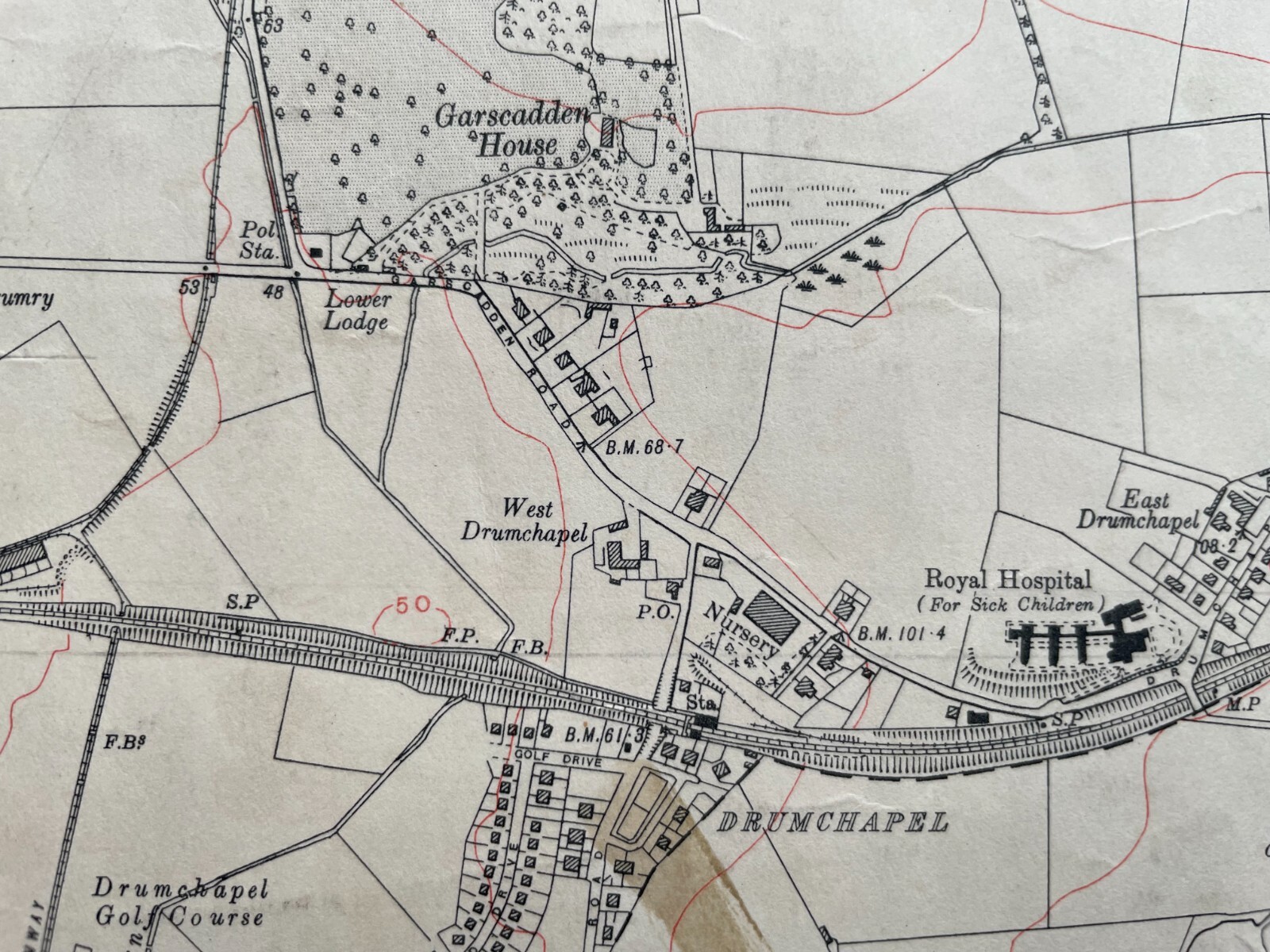

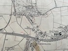
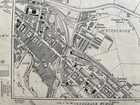
1933 Edition Topographical Map of the Bearsden, Dumbartonshire XXIII. SE
GBP 25.00
ApproximatelyPHP 1,885.13
or Best Offer
Condition:
“The map is generally in good condition; although it has a few marks and an ink stain towards the ”... Read moreabout condition
Oops! Looks like we're having trouble connecting to our server.
Refresh your browser window to try again.
Shipping:
GBP 23.77 (approx PHP 1,792.38) International Priority Shipping to United States via eBay's Global Shipping Program.
Located in: Falkirk, United Kingdom
Import charges:
Free amount confirmed at checkout
Delivery:
Estimated between Wed, 2 Jul and Fri, 11 Jul to 94104
Includes international tracking
Returns:
14 days return. Buyer pays for return shipping. If you use an eBay shipping label, it will be deducted from your refund amount.
Coverage:
Read item description or contact seller for details. See all detailsSee all details on coverage
(Not eligible for eBay purchase protection programmes)
Seller assumes all responsibility for this listing.
eBay item number:176658077372
Item specifics
- Seller Notes
- Antique
- Yes
- Date Range
- 1933
- Type
- Topographical Map
- Format
- Flat/Rolled
- Printing Technique
- Thick paper
- Year
- 1933
- Era
- 1930s
- Original/Reproduction
- Antique Original
- Cartographer/Publisher
- Ordnance Survey
- City
- Glasgow
- Country/Region
- Scotland
- County
- Dunbartonshire, Lanarkshire, Renfrewshire
Item description from the seller
Seller feedback (157)
- l***h (652)- Feedback left by buyer.Past monthVerified purchaseNice item to compliment my enamel sign from this particular colliery very good seller prompt despatch
- t***7 (789)- Feedback left by buyer.Past 6 monthsVerified purchaseOrdnance survey map of Wishaw 1/4 sheet sent by return of post packaged well and well described thanks
- r***m (7938)- Feedback left by buyer.Past 6 monthsVerified purchaseGood item, smooth transaction, thanks.