Picture 1 of 3


Gallery
Picture 1 of 3
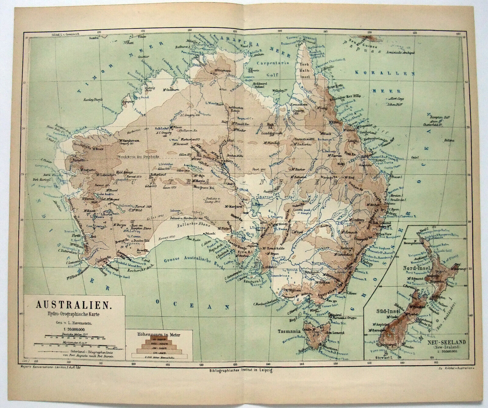


Australia & New Zealand - Original 1874 Hydro-Orograph
US $17.00
ApproximatelyPHP 947.07
Condition:
“Some age toning, minor wear and one center fold, otherwise this attractive vintage map is in good ”... Read moreabout condition
Oops! Looks like we're having trouble connecting to our server.
Refresh your browser window to try again.
Shipping:
Free USPS Ground Advantage®.
Located in: Sayville, New York, United States
Delivery:
Estimated between Fri, 6 Jun and Mon, 9 Jun to 94104
Returns:
30 days return. Seller pays for return shipping.
Coverage:
Read item description or contact seller for details. See all detailsSee all details on coverage
(Not eligible for eBay purchase protection programmes)
Seller assumes all responsibility for this listing.
eBay item number:146516125046
Item specifics
- Seller Notes
- Date Range
- 1800-1899
- Type
- Physical Map
- Printing Technique
- Lithography
- Subgenre
- Australia & New Zealand
- Format
- Atlas Map
- Year
- 1874
- State/Territory
- Australian Capital Territory, Jervis Bay Territory, New South Wales, Northern Territory, Queensland, South Australia, Tasmania, Victoria, Western Australia
- Original/Reproduction
- Original
- Country/Region
- Australia, New Zealand
- Topic
- Maps
Item description from the seller

Popular categories from this store
Seller feedback (6,269)
- w***1 (1628)- Feedback left by buyer.Past monthVerified purchaseGreat seller
- a***a (956)- Feedback left by buyer.Past monthVerified purchaseMap as described. Fast,well-packaged shipping.
- a***r (642)- Feedback left by buyer.Past monthVerified purchaseJust as described. Well packaged.