Ohio Antique Original Antique North America Folding Maps
All
Auction
Buy It Now
23 Results
The Rand-Mcnally Vest Pocket Map Of OHIO and Indiana Damaged lot of 2
PHP 5,177.79PHP 5,663.41 shippingThe Rand-Mcnally Vest Pocket Map Of OHIO Showing All Counties, Cities,
PHP 4,602.42PHP 5,646.72 shippingVintage Rare 1909 OHIO MAP - CONGRESSIONAL DISTRICTS - RAILROADS - ELECTRIC LINE
PHP 3,092.64PHP 2,753.74 shippingAntique US Map Colonies Northern Frontiers NY NJ Pennsylvania PA Ohio 1768 Gavit
PHP 4,775.03Was: PHP 5,753.16PHP 1,898.73 shippingAntique 1903 Map Ashtabula Ohio area Geneva Jefferson Kingsville 29"X21" #21033
PHP 2,295.74PHP 1,825.66 shipping1892 Antique Map Coshocton & Holmes Counties Ohio Millersburg New Castle Chili
PHP 1,700.23Was: PHP 1,789.41PHP 1,909.67 shippingRand-McNally regional state map: EASTERN UNITED STATES © 2004 - paper
PHP 1,493.10PHP 1,564.44 shipping1855 Map of Canada, Promotion, Emigration, Railways & Canals, Paris Expo.
PHP 7,479.86PHP 2,325.09 shipping1880 Hardesty, Sectional & Township map of Ohio, very large 24 inch
PHP 13,913.69PHP 409.67 shippingAntique Map 1906 Wheeling West Virginia Ohio Liverpool Steubenville 16X47 #21113
PHP 2,865.36PHP 1,949.94 shipping3 Folding Maps State of Ohio Geology Vertical Horizontal Control Topography 1910
PHP 2,589.18PHP 1,826.81 shipping1907 Economic & Structural Map of Kenova Quadrangle Kentucky West Virginia Ohio
PHP 977.56PHP 1,845.80 shippingMap FRONTIERS OF THE NORTHERN COLONIES + 1768 Fort Stanwix Treaty with Indians
PHP 7,766.97PHP 1,121.40 shippingFolded Geological Index Map Ohio Columbus Cincinnati Cleveland Toledo 1949
PHP 2,589.18PHP 1,826.81 shippingAntique Map 1906 Meigs County Ohio Middleport Pomeroy Rushville Portland #13209
PHP 1,682.39PHP 1,914.84 shippingTravel Roads Highways Highway Detour Bulletin Map State of Ohio 1928
PHP 2,186.42PHP 1,936.13 shippingAntique Map 1906 Meigs County Ohio Middleport Pomeroy Burlingham 36X25" #21134
PHP 2,865.36PHP 1,949.94 shippingAntique 1914 Map Paulding County Ohio Cecil Antwerp Payne Haviland Latty #17033
PHP 1,714.61PHP 1,916.00 shippingVintage CLEVELAND OH Folded Road Map Mandley Realty 1950s 33196
PHP 632.34Was: PHP 1,150.17PHP 1,967.78 shippingFolded Color Soil Survey Map Washington County Ohio Marietta Belpre Beverly 1930
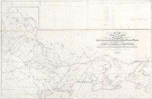
PHP 2,589.18PHP 1,826.81 shipping1972 Army Engineers Folded Map///OHIO RIVER BASIN MAP, PLAN OF DEVELOPMENT
PHP 572.50PHP 1,537.40 shipping1951 Ohio Official Highway Map
PHP 574.80PHP 1,776.18 shipping1880 Hardesty, Sectional & Township map of Ohio, very large 24 inch
PHP 12,930.90PHP 1,293.09 shipping