London Antique Europe Folding Maps
90 Results
Retro Vintage Bus train Transport Map guide Of London Transport inter city
PHP 1,227.34PHP 2,571.71 shippingRetro Vintage Bus train Transport Map guide Of London Transport
PHP 1,227.34PHP 2,571.71 shippingRetro Vintage Bus train Transport Map guide Of London Transport
PHP 1,227.34PHP 2,571.71 shippingRetro Vintage Bus train Transport Map guide Of London Underground Transport
PHP 981.73Was: PHP 1,227.34PHP 2,553.65 shippingAntique Map Britannia Antiqua Adcurante Johanne Horsley C1877 UK Engraving
PHP 721.67PHP 357.58 shipping1946 Kew Royal Botanical Gardens O.S.Key Pan Map & Train & Trolleybus route Map
PHP 361.190 bidsPHP 520.12 shippingEnding May 7 at 5:35AM PHT4d 8h1933 Pictorial Plan of London by Geographia In Original Guide
PHP 2,889.56PHP 505.67 shippingBacon's New Large Print Map of London and Suburbs - Circa 1914
PHP 2,528.36PHP 3,021.03 shippingAntique Map Britannia Antiqua Ancient Britain C1870's Map Of The World
PHP 1,010.62PHP 357.58 shippingVintage Bacon's Cycling Road Map Of The Environs London N.E.
PHP 1,083.58PHP 2,387.50 shipping1816-19 MAPS Environs of London by Col MUDGE at the Tower 4 Sheets in a Slipcase
PHP 68,626.98PHP 2,311.65 shipping1891 Map of London and environs - F.S. Weller / London, Cassell & Company
PHP 938.38PHP 2,839.71 shippingSHOREDITCH 1872 - Old Ordnance Survey Maps Godfrey Edition
PHP 325.08PHP 325.08 shippingRetro Vintage Bus train Transport Map guide Of London Transport
PHP 981.73Was: PHP 1,227.34PHP 2,553.65 shippingRetro Vintage Bus train Transport Map guide Of London Transport
PHP 981.73Was: PHP 1,227.34PHP 2,553.65 shippingRetro Vintage Bus train Transport Map guide Of London Transport 1968
PHP 1,227.34PHP 2,571.71 shipping1919 Original Old Folding Muirhead Guide Tube & Tramway Map of London 17" x 13"
PHP 3,250.75PHP 588.75 shippingVintage London 1652 Tissue Paper Map 33cm X 33cm Stained Crinkled Torn Folded
PHP 718.78PHP 2,733.52 shippingAntique Map "New Map of Central London Divided into Quarter Mile Squares" 1870
PHP 8,668.67PHP 1,300.30 shipping1953 Historic Queen Elizabeth II Royal Coronation Route Map London Pictorial
PHP 25,332.99PHP 750.61 shipping1874 Reynolds's "New Map of London With The Recent Improvements" Hand Coloured
PHP 16,253.76PHP 1,155.82 shippingAntique Map "Stanford’s Map of the County of London(Sheet 4)" E. Stanford, 1901
PHP 22,032.87PHP 1,300.30 shipping4x Cloth London Ordnance Survey Vintage Road Maps
PHP 1,950.45PHP 2,798.54 shippingRare Antique THE "COMBINED" MAPS OF LONDON & 25 MILES AROUND - H. Grube
PHP 2,527.64PHP 934.05 shippingHAMPSTEAD 1866 - Old Ordnance Survey Maps Godfrey Edition
PHP 325.08PHP 325.08 shippingNORTH HAMMERSMITH & BEDFORD PARK 1912 - Old Ordnance Survey Maps Godfrey Edition
PHP 325.08PHP 325.08 shippingBacon’s Map Of The Environs Of Croydon - London - Cloth
PHP 1,441.17PHP 2,761.69 shippingDALSTON 1870 - Old Ordnance Survey Maps Godfrey Edition
PHP 325.08PHP 325.08 shippingNew Reduced Ordnance Survey Map The Environs Of London John Bartholomew 2 Mile
PHP 649.43PHP 2,356.43 shippingNew Reduced Survey Map of Glasgow & Clyde John Bartholomew Tourist 4 Mile inch
PHP 721.67PHP 2,361.49 shipping1947 Vintage Folding Guide Map Railway & Road Map of London England 11.5" x 10"
PHP 2,167.17PHP 588.75 shippingAntique Map London & Thames Estuary - Virtue & Co Ltd London 1885 13" x 10.5"
PHP 2,889.56PHP 975.23 shippingSTAMFORD HILL 1894 - Old Ordnance Survey Maps Godfrey Edition
PHP 325.08PHP 325.08 shippingGeorge Cruchley c.1835 Folding Map of (Central) London In Original Slipcase
PHP 17,698.54PHP 1,083.58 shippingRICHMOND HILL & EAST SHEEN 1894 - Old Ordnance Survey Maps Godfrey Edition
PHP 325.08PHP 325.08 shippingVintage 1978 East London MAP 177 Ordnance Survey One-Inch Map Topography History
PHP 505.67PHP 2,346.32 shipping1757 Antique Folding Map: Rocque's Map of Middlesex
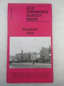
PHP 90,298.66PHP 1,119.70 shippingSTRATFORD 1914 - Old Ordnance Survey Maps Godfrey Edition
PHP 325.08PHP 325.08 shipping1926 Old Folding Plan of Central London Section 3 John Bartholomew 33" x 6.75"
PHP 2,889.56PHP 588.75 shippingVintage London Postal Districts Map Colored Edition
PHP 1,445.01PHP 1,570.49 shippingVintage Map of London & Suburbs 1932 Bacon`s New Large Print 1s.6d Antique
PHP 3,611.22PHP 2,743.63 shippingA-to-Z Map - 35 Miles Around London
PHP 288.96PHP 2,525.47 shippingSTOKE NEWINGTON 1868 - Old Ordnance Survey Maps Godfrey Edition
PHP 325.08PHP 325.08 shippingSTAMFORD HILL 1868 - Old Ordnance Survey Maps Godfrey Edition
PHP 325.08PHP 325.08 shippingAA Duplex Map of London & the Home Counties (1934) Paper on Linen, Throughway
PHP 938.38PHP 1,152.21 shippingNORTH WOOLWICH 1869 - Old Ordnance Survey Maps Godfrey Edition
PHP 325.08PHP 325.08 shipping1891 Map of Berlin and environs - F.S. Weller / London, Cassell & Company
PHP 1,155.10PHP 2,854.88 shippingSTOKE NEWINGTON 1914 - Old Ordnance Survey Maps Godfrey Edition
PHP 325.08PHP 325.08 shippingSTOKE NEWINGTON 1894 - Old Ordnance Survey Maps Godfrey Edition
PHP 325.08PHP 325.08 shipping1939 Old Folding Plan of London & 12 Miles Around John Bartholomew 13.5" x 13.5"
PHP 2,167.17PHP 588.75 shippingOld Folding Plan of Central London 1930 Section 2 Ward Lock & Co 33" x 6.75"
PHP 1,805.97PHP 588.75 shippingSHOREDITCH 1893 - Old Ordnance Survey Maps Godfrey Edition
PHP 325.08PHP 325.08 shippingCHARLES BOOTH POVERTY MAP Bow Bethnal Green Stepney Limehouse 1902
PHP 21,671.68PHP 3,665.40 shipping10 watchingNew ListingBartholomew's Survey Plan Guide London Circa 1910 Folding Map 23X33 Linen Backed
PHP 1,445.590 bidsPHP 2,113.45 shippingEnding May 9 at 10:12AM PHT6d 13hBartholomews Historical Map Of London Cloth + Geographia LONDON Street Plan
PHP 1,445.59PHP 1,917.43 shippingPhilips' Cyclists' Map Of 100 Miles Round London Pub By George Philip & Son Ltd
PHP 361.19PHP 2,588.32 shippingLondon Ramblers Chiltern map NW section 55 Fleet Street Footpaths & Bus Routes
PHP 866.87PHP 2,762.42 shippingVintage 1970 London S.W. MAP 170 Ordnance Survey One-Inch Map Topography History
PHP 577.91PHP 2,351.38 shipping1939 Old Folding Plan of Central London Section 3 John Bartholomew 33" x 6.75"
PHP 2,889.56PHP 588.75 shippingVintage "Geographia" Cloth Map, 20 Miles Round London, Arterial & Bypass Roads
PHP 1,805.25PHP 2,787.70 shipping